
In 2019, MHI sent a low-flying helicopter along a 30-mile stretch of transmission line in rural Illinois to collect high-definition images of ageing towers and line attachment points.
Invenergy, a global developer and operator of sustainable energy solutions, enlisted MHI to conduct a LiDAR survey and modelling project to identify problems along its Bishop Hill 138 kV transmission line. With the help of Aethon Aerial Solutions, MHI was able to meet the specialized inspection requirements and minimize the cost to Invenergy by integrating new and innovative camera technology.
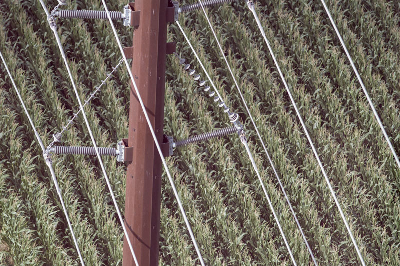
This was the first time MHI used imagery collected by Aethon’s proprietary Autonomous Inspection Capture (AIC) system for detailed visual inspection. The high-resolution images captured from multiple angles on both sides of the line allowed MHI’s engineers and technicians to identify deficiencies, not possible with typical imagery collected during LiDAR surveys. Using this approach, MHI was able to locate items like loose bolts, missing cotter keys, and damaged insulators.
Throughout the eight-week project, MHI coordinated a LiDAR survey, collected images of the transmission line structures and provided the right of way (ROW). This data was compiled to create models using PLS-CADD software and allowed MHI to provide Invenergy with a prioritized listing of all deficiencies.
MHI will continue to work with Aethon Aerial Solutions to showcase how this technology can bring value to the operation and maintenance of a utility’s transmission lines.